Darien, Connecticut
| Darien, Connecticut | |||
|---|---|---|---|
| — Town — | |||
| Rings End Bridge | |||
|
|||
 |
|||
| Coordinates: | |||
| Country | United States | ||
| State | Connecticut | ||
| Region | South Western Region | ||
| Incorporated | 1820 | ||
| Government | |||
| - Type | Representative town meeting | ||
| - First selectman | David Campbell | ||
| Area | |||
| - Total | 23.4 sq mi (60.6 km2) | ||
| - Land | 12.9 sq mi (33.4 km2) | ||
| - Water | 10.6 sq mi (27.4 km2) | ||
| Elevation | 52 ft (16 m) | ||
| Population (2005) | |||
| - Total | 20,452 | ||
| - Density | 1,585/sq mi (612/km2) | ||
| Time zone | Eastern (UTC-5) | ||
| - Summer (DST) | Eastern (UTC-4) | ||
| ZIP code | 06820 | ||
| Area code(s) | 203 | ||
| FIPS code | 09-18850 | ||
| GNIS feature ID | 0213416 | ||
| Website | www.darien.org | ||
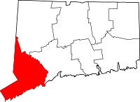
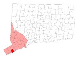
Darien is a town in Fairfield County, Connecticut, United States. A relatively small community on Connecticut's "Gold Coast", it is one of the most affluent towns in the United States. The population was 19,607 at the 2000 census.
Situated between the small cities of Norwalk and Stamford, the town is a bedroom community with relatively few office buildings. Most workers commute to the adjacent cities, and many also work in New York City. Two Metro North railroad stations — Noroton Heights and Darien — link the town to Grand Central Terminal and the rest of the New Haven Line. Although Darien has an increasingly vibrant downtown, residents often shop at the big-box stores and chain stores in neighboring Norwalk and Stamford. For recreation, the town includes four small parks, two beaches on Long Island Sound, four country clubs, a hunt club, and two yacht clubs.
With a median home price of approximately $1 million, Darien is one of the most expensive places to live in North America, and was rated one of the best places to live in America by CNN in 2005.
The public library in Darien, the Darien Library, has consistently ranked in the top ten of its category in the HAPLR (Hennen's American Public Library Ratings) Index of libraries.
Contents |
Local pronunciation of the town name
Residents pronounce rhyme the name of the town with "Mary Ann," with the stress on the last syllable: /dɛəriˈæn/ dair-ee-an). More common in the mid-to-late 20th Century was "dare-i-YEN" (short "e" sound vice short "a"), spoken quickly.
"You can always tell when someone is not from here because they do pronounce it the way it’s spelled," Louise Berry, director of the town library, said in a 2006 interview.[1]
The town name was "frequently pronounced Dairy Ann" at least as far back as 1913, as reported in a travel book published that year.[2]
The village of Darien, Wisconsin shares this pronunciation.
Government and politics
See: Government and politics of Darien, Connecticut
Elected bodies in the town government are a five-member Board of Selectmen, a nine member Board of Education, a seven-member Board of Finance, a six-member Planning and Zoning Commission, three-member Board of Assessment Appeals, and a 100-member, nonpartisan Representative Town Meeting. The town has several elective offices as well: the town clerk, probate judge, registrar of voters, tax collector and treasurer.[3]
The Board of Finance approves financial measures, including the town budget; the Board of Education controls the town's public schools; the Representative Town Meeting is the main legislative body of the town.
As of December 1, 2005, the town had 12,099 registered voters, with 6,445 Republicans (53.1 percent), 1,940 Democrats (16 percent) and 3,703 unaffiliated voters (30.6 percent).[4] Darien is primarily a Republican town, voting for George W. Bush in 2000 and 2004, and John McCain in the 2008 election. However, in 2003, Evonne Klein replaced Robert Harrel as First Selectman, becoming the first Democrat to win the post in 14 years. Klein was re-elected in 2005 and again in 2007, but did not run in the November 3, 2009 election, which was won by Republican David Campbell.[5]
Post 53
An ambulance service, known as "Darien EMS – Post 53" is the only ambulance service in the nation staffed and run entirely by high school student volunteers.[6] The Explorer post is chartered under the Connecticut Yankee Council, and is considered a scouting unit.
The service provides emergency care at no cost to the patient, funded entirely by private donations from town residents. Teenagers are allowed to perform patient care due to the fact that Connecticut is one of the few states in the nation which allows Emergency medical technicians to be certified at age 16.[7]
Students will start training while they are in their freshman year of high school. They are elected by current members of Post and then they continue their training
Supervised by trained adults, Post 53 lets in 20 teenagers a year to join the crew. "Each student receives at least 150 hours of training for basic certification as emergency medical technicians; by their senior year, some even qualify to drive the ambulance."[8]
Geography
According to the United States Census Bureau, the town has a total area of 14.8 square miles (38.4 km²), of which, 12.9 square miles (33.3 km²) of it is land and 2.0 square miles (5.2 km²) of it (13.41%) is water. The town has four exits on the northbound-traffic side of Interstate 95 (Exits 10–13) and three on the southbound-traffic side (where there is no Exit 12) its northern border is just south of the Merritt Parkway, where Exits 36 and 37 are closest to the town. It also has two Metro North railroad stations for commuter trains into New York City, with a 38-39 mile commute of 46–50 minutes from Noroton Heights, 49-53 from Darien (the Talmadge Hill railroad station, on the New Canaan line is within walking distance of homes at the far northwestern corner of town, and the Rowayton railroad station is within walking distance of homes near Raymond Street in the southeastern part of town). Most trains run non-stop after Stamford into New York City's 125th Street, then Grand Central Terminal. Along with the New Haven Line of Metro-North Railroad and Interstate 95, US Route 1, known locally as the Boston Post Road, or, more commonly, the Post Road, runs east-west through the southern side of town. Except for the Noroton Heights business district, commercial zoning is extremely limited outside of the town-wide strip along the Post Road.
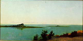
Darien is bordered on the west by Stamford, on the north by New Canaan, and on the east by Norwalk. On the south it faces Long Island Sound. It is part of the "panhandle" of Connecticut jutting into New York state. The town has 16.5 miles (26.6 km) of coastline and five harbors.
Sections of the Town

In addition to some small neighborhoods, the larger divisions of the town are Noroton (roughly in the southwest corner of town), Noroton Heights (roughly north of Interstate 95 to Middlesex Rd with an eastern boundary somewhere east of Noroton Avenue), and Tokeneke, in the southeastern end of town. Springdale is West of Wee Burn Country Club and South of Woodway Country Club, centered around St. John's Catholic Cemetery, across the Stamford border from the Springdale section of Stamford.
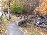
The name "Noroton" originates from an Indian word assigned to the river along Darien's border with Stamford. This section of Darien is defined by two peninsulas that claw their way into Long Island Sound, their curved appendages protecting enough coves and inlets to make the area a haven for beachgoers and sailors. The shorter of the peninsulas, Noroton Neck, is divided into shore communities like Noroton Bay and Pratt Island.[8] Long Neck peninsula, which extends farther into Long Island Sound, provides westerly views of Manhattan. Accessed by the Ring's End Landing bridge, a graceful stone structure that marks a major shipping point for early settlers, Long Neck became a summer destination for the wealthy when rail travel made it accessible during the mid-1800s.[8] Though the general geographic reference to this land feature is 'Long Neck Point', therein are two different neighborhoods, each with their own main road and distinct features. On its east side, Long Neck Point Road stretches south beginning at Ring's End/Gorham's Pond Bridge and terminates at the southerly most tip of land. This area is somewhat inland and away from the eastern shoreline and at a relatively high elevation above the water. Pear Tree Point Road, also beginning at Ring's End/Gorham's Pond Bridge, runs south along the western side of the Point adjacent to 'The Gut' and to outer Noroton Harbor. This charming route hugs the shoreline at an elevation close enough to the tides (at some points) such that storm conditions can bring the salt water harbor over the road. Approximately half-way south along the peninsula, Pear Tree Point Road turns abruptly to the east, ninety degrees, heading uphill and connecting to Long Neck Point Road.
Noroton Heights "grew up around the Noroton Heights train station and housed the European immigrants who serviced the old estates," according to an article about the community in The New York Times. The densely populated streets of this part of town are full of "modest Capes and colonials" along with other house styles.[8]
History

For more information, see: History of Darien, Connecticut
The Town of Darien, Connecticut, has a rich history. According to early records, the first clearings of land were made by men from the New Haven and Wethersfield colonies and from Norwalk in about 1641. It was not until 1740, however, that the Middlesex Society of the Town of Stamford built the first community church, now the First Congregational Church of Darien (which stands on the original site at the corner of Brookside Rd. and the Boston Post Road).[9]
The area became Middlesex Parish in 1737. It was incorporated as the Town of Darien in 1820. Tories raided the town several times during the American Revolution, at one point taking 26 men in the parish prisoner for five months, including the Rev. Moses Mather, pastor of the parish. The Tory-Patriot conflict in Darien is the setting for the novel Tory Hole, the first book by children's author Louise Hall Tharp.

According to the Darien Historical Society[10], the name Darien was decided upon when the residents of the town could not agree on a name to replace Middlesex Parish, many families wanting it to be named after themselves. A sailor who had traveled to Darién, Panama, then part of Colombia, suggested the name Darien, which was eventually adopted by the people of the town.
Until the advent of the railroad in 1848, Darien remained a small, rural community of about 1,000. After the Civil War, the town became one of the many resorts where prosperous New Yorkers built summer homes. A few daily commuters to New York City then were forerunners of the many who have settled here and changed Darien into a residential suburb of metropolitan New York.
Gentleman's Agreement and sundown towns
Laura Z. Hobson's bestselling 1947 novel Gentleman's Agreement was set in Darien. The book highlights American anti-Semitism via an unwritten covenant that prohibited real estate sales to Jews.
Historian James Loewen's 1999 book Lies Across America paints Darien as a "Sundown town" "notorious for [its] racial policies." In or around 1948, according to resident Larry Abbott, a sign hung on Hollow Tree Ridge Road reading "Gentiles Only.
Economy
JetBlue Airways has finance and scheduling operations in Suite 23 at 19 Old Kings Highway South in Darien.[11] By mid-2012 JetBlue will combine the Darien and Forest Hills, Queens, New York City headquarters into its headquarters in Long Island City, Queens.[12]
Education
Darien is served by Darien Public Schools. Darien has five Elementary Schools: Hindley School, Holmes School, Ox Ridge School, Royle School, and Tokeneke School. A $27 million addition was completed in 2000 to the town's middle school, Middlesex Middle School, and a new $73 million campus for Darien High School was completed in the fall of 2005.[8]
Pear Tree Point School, originally named Plumfield School, is a private school on Long Neck, educating students in pre-kindergarten through Grade 5.[13]
Transportation
The town is served by two train stations, the Noroton Heights and the other in downtown Darien. The Connecticut Turnpike runs through town, as does the Post Road, U.S. Route 1. Just to the north of town, the Merritt Parkway, Route 15 runs roughly parallel to the northern border between Darien and New Canaan. The Talmadge Hill railroad station is just north of the border as well. Along with the Post Road, major east-west thoroughfares in town are West Avenue and Middlesex Road. Major north-south roads are Hoyt Street, Hollow Tree Ridge Road, Nearwater Lane, Noroton Avenue, Middlesex Road, Mansfield Avenue and Brookside Road.
Interstate 95 has rest stops in Darien both for the southbound and northbound lanes. The state Department of Transportation has added "speed change" lanes between entrances and exits up to Exit 10 (and points westward). The phase of the highway widening from Exit 9 to Exit 10, at a cost of $7.5 million, is expected to be complete by October 2007, state Transportation officials said in August of that year. The state is in the process of planning more such lanes through the rest of the highway in town in a project expected to cost $24.5 million. About 150,000 vehicles pass Exit 12 each day, according to the state Department of Transportation. The state was considering closing the southbound entrance for Exit 12 in 2008 during work on the project.[14]
Chapter 14 of English author Nigel Williams 1994 travelogue From Wimbledon to Waco tells of his difficulties in reaching Darien from Interstate 95.
In December 2007 a 15-month, $5.5 million project was completed to add fourth (or "operational") lanes in each direction between the entrances and exits at Exits 10 and 11 in Darien. An earlier project added a fourth lane on the southbound side from the entrance at Exit 10 to Exit 8. After that lane was added, a state Department of Transportation study concluded that accidents were down on that stretch of the highway by 20 percent, amounting to about 160 fewer accidents per year. Construction of operational lanes at exits 11, 12, and 13 was expected to begin in the late spring of 2008.[15]
Local media
Darien is served by two local weeklies: the Darien Times and the Darien News-Review. Most public meetings are filmed and broadcast live, and recorded for later broadcast by Cablevision's Channel 79 Government Access.[16]
Recreation

- Darien Y — the local YMCA, offers more than 300 programs.[17]
- YWCA of Darien-Norwalk is located in Darien.[18]
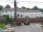
- The Depot — an adult-supervised youth center for town teenagers in the former Noroton Heights Railroad Station building since the organization's founding in 1989. A student board runs the day-to-day programming; an adult board focuses on fundraising, operations management and capital building projects.[19]
- "Darien Playhouse" — Darien's sole commercial cinema
- Darien is also the home of the largest little league program in the United States with 1,474 boys and girls participating.
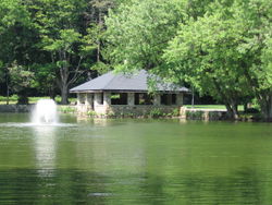
Parks and beaches
- Cherry Lawn Park — 27.5 acres (111,000 m2), 120 Brookside Road
- Weed Beach — 22.12 acres (89,500 m2) at 155 Nearwater Lane, Noroton
- Pear Tree Point Beach — 7.95 acres (32,200 m2) at 127 Pear Tree Point Road
- Woodland Park Nature Preserve — 64.717 acres (261,900 m2) on Middlesex Road
- Baker Park — 11.72 acres (47,400 m2) at 75 Noroton Ave. (site of the former Baker School)
- Frate Park — 0.83 acres (3,400 m2) at the corner of Middlesex Road and Leroy Avenue
- McGuane Park — 7.5 acres (30,000 m2), 221 Noroton Ave.
- Selleck's Woods Nature Preserve — 28.093 acres (113,690 m2) on Little Brook Road
- Stony Brook Park — 11.3 acres (46,000 m2) on Ledge Road
- Town Hall and Holahan Fields — 10 acres (40,000 m2) at 2 Renshaw Road
- Tilley Pond Park — 8.651 acres (35,010 m2) on Lakeside Avenue
Restricted membership clubs
- Country Club of Darien — The club has the second-largest estimated property value of any entity in town, with $23.2 million in assessed value (equal to 70 percent of estimated actual value) behind only the Wee Burn Country Club.[20]
- Darien Boat Club — founded in the late 1940s, the club's membership has grown from a few charter members to more than 850, as well as their families.
- Noroton Yacht Club — Former members of "the world-renowned" club "have included two America's Cup skippers." The club runs the largest junior sailing program in the county.[8] The club was founded in 1928 and built its first clubhouse the following year.
- Ox Ridge Hunt Club — On 37 acres (150,000 m2), the club hosts a popular annual horse show held since 1926. The club was founded in 1911.[21]
- Piedmont Club — Not a country club, the "Società Umberto Principe di Piemonte, Inc." was organized July 15, 1916 and "a well-appointed and commodious clubhouse" just off Noroton Avenue was erected in 1923, according to a town history published in 1935.[22]
- Tokeneke Club — When developers of Tokeneke were trying to sell real estate there, they found that ensuring access to a beach removed some hesitation on the part of prospective buyers, so they founded the Tokeneke Beach Club in 1907, acquiring "a small stretch of shore on which stood a dilapidated double-decker bathhouse and a broken pier," soon replaced.[23] The club's original wooden buildings caught fire at a Saturday night party in 1932 and burned to the ground; replacement buildings were later battered by hurricanes.[24][25]
- Wee Burn Country Club — formed in 1895, it is the first organized golf club in the state and "either the second or third in the United States." The name of the club was taken from a small stream, Stony Brook, which ran through the old grounds. Originally a small house on the Post Road in Noroton (across the street from St. Luke's Episcopal Church[26]) was rented for a clubhouse and nearby land for a seven-hole course was rented. The lease stipulated that the links couldn't prevent the landlord from continuing to use the fields as pasture for his cows. Eventually more land was bought on Hollow Tree Ridge Road[27] and the course was enlarged to nine holes and then 18 by (at the latest) the 1930s.[28] The club is the largest taxpayer in Darien, with an assessed property value (equal to 70 percent of estimated value) of $29.8 million.[20] As recently as 1999, the club did not allow women as full members - they were subject to restricted tee times and barred from the clubhouse.[29]
- Woodway Country Club — founded in 1916 when some members of the Wee Burn Country Club decided the small Wee Burn links, then near the Post Road in Noroton, were getting too crowded. The club bought 150 acres (0.61 km2) of land in Darien and another 45 in Stamford, and an 18-hole course was opened July 1, 1918.[30] The club was the sixth largest taxpayer, according to the October 1, 2004 town Grand List. The assessed value of the property (equal to 70 percent of actual estimated value) was $19.9 million.[20]
- Middlesex Club — private swim and tennis club
Boy Scouts
Darien has many active scout units, including two Boy Scout troops, a Boy Scout Ship, and Explorer Post 53 (see Post 53 section, above), as well as three Cub Scout packs. Both troops and the ship are funded by the Andrew Shaw Memorial Trust; other funding comes from the annual May tag sale at the Scout Cabin on West Avenue, which has raised more than $50,000 in some years. These Scout units are in town:
- Packs 55, 56, and 161 — open to boys in 1st through 5th grades.
- Troop 35 — founded in 2004 when the town's existing troop (Troop 53) got too big; open to boys ages 11–18.
- Troop 53 — the town's original Boy Scout troop, founded in 1918; open to boys ages 11–18.
- Ship 53 — founded in recent years to let kids continue their scouting experience on the water; open to boys and girls ages 14–21.
- Post 53 — see above entry
Annual events
- May — Boy Scout Troop 35 and 53 Tag Sale
- May — Hindley Happening Fair
- Memorial Day — Post 53 Food Fair at Tilly Pond Park and Memorial Day Parade
- Summer — annual Sidewalk Sale (sponsored by the Darien Chamber of Commerce)
- October — Tokeneke Big Pumpkin Fair
Ox Ridge Hunt Club Charity Horse Show
The Ox Ridge Hunt Club sponsors this annual June event, which has attracted up to 16,000 spectators and 1,300 equestrians, some from as far away as California and Europe. The 2007 Grand Prix event offered a $25,000 prize. The three-day event is free to spectators.[31]
Philanthropic groups
- A Better Chance — for information on the Darien chapter, see Darien High School
- Center for Hope is an organization set up in the early 1980s to provide bereavement and critical illness support for adults and children living with an illness, grieving a loss or coping with a trauma. "All counseling, support and education services are facilitated by specially-trained professionals in an atmosphere of hope and renewal", according to the organization. Founded in the early 1980s, the Center For Hope merged with Family Centers Inc. in 2005.[32]
- Children's Council of Darien is a group set up to provide information and advocacy for the town's children from birth through fifth grade. It describes itself as a nonpartisan group of "parents, educators, doctors and local agency members working together in a non-profit organization to better inform the community about children's needs."[33]
- The Community Fund of Darien, formerly The Darien United Way and Community Council, traces its origins to 1924 and assumed its current name upon withdrawing from the national United Way system in 2006. The Community Fund is a 501(c)(3) Public Charity actively working to meet health and human service needs in the greater community – primarily in Darien, Norwalk and Stamford – through strategic and financial leadership.[34]
- CTE is a nonprofit organization founded in 1967 with a mission of countering "the basic causes of poverty in the Greater Stamford Area", according to the group's Web site. The organization is the federal and state designated Community Action Agency for Stamford, Greenwich and Darien.[35]
- Darien Book Aid Plan is a nonprofit, all-volunteer organization that distributes free books in response to specific requests from Peace Corps volunteers, libraries and schools worldwide. Books are also donated within the United States to libraries, prisons, and hospitals, along with Native American and Appalachian groups.[36]
- Darien Community Association is a nonprofit group founded more than 83 years ago which provides educational, cultural, recreational and civic programs; raises funds for scholarships and other community philanthropic works (partly through its Darien Thrift Shop); and maintains the Meadowlands mansion as a community resource.[37]
- Darien/Stamford Chapter of the American Red Cross was formed on January 1, 2007 by the merger of the Darien and Stamford chapters of the American Red Cross. The merger created an organization with an annual budget of about $850,000, a staff of six full-time employees and about 600 volunteers.[38]
- Darien Technology & Community Foundation
- Junior League of Stamford-Norwalk, founded in 1923, is a 501(c)(3) non-profit organization of women committed to promoting voluntarism, developing the potential of women and improving the community through the effective action and leadership of trained volunteers. Its purpose is exclusively educational and charitable. The League focuses its financial and volunteer assets on the issues of positive youth development, child health and welfare and self-sufficiency for women.[39]
- Person-to-Person A 501(c)(3) non-profit agency originally established in 1968 by St. Luke’s Episcopal Church in Darien. Its mission is simple: to bring together the needs of people in disadvantaged areas of nearby communities with the resources of people in Darien and the surrounding areas, thereby providing basic emergency services to low-income individuals and families living in lower Fairfield County. A volunteer-driven agency, Person-to-Person is committed to helping clients achieve self-sufficiency through practical help, advocacy, education and problem-solving initiatives. Programs include Emergency Assistance, Campership and Scholarship. In 2007, Person-to-Person helped more than 20,000 people avert crisis and make ends meet. These efforts are made possible by in-kind donations, a force of more than 2,000 volunteers and financial contributions.[40]
Notable residents
For more information, see List of people from Darien, Connecticut

Several people notable for their esteemed place in American history have called Darien home: Charles Lindbergh the late aviator, and his wife, author Anne Morrow Lindbergh lived on Tokeneke Trail. Steel magnate and philanthropist Andrew Carnegie vacationed for several summers at what became the Convent of the Sacred Heart (divided into many private estates in the 1970s) at Long Neck Point.[22] Christopher Shays, the former Republican congressman representing Connecticut's Fourth District, was born in Darien (and now lives in Bridgeport).
Actors and actresses who have lived in town include former resident Christopher Plummer (who lived on Long Neck Point, and now lives in Weston), Kate Bosworth, Topher Grace, and Chloë Sevigny. Actres Carol Kane attended Cherry Lawn School in Darien until 1965. Film director Gus Van Sant went to high school in Darien. Gerry Mulligan,one of the leading baritone saxophonists in jazz history, lived in Darien in later life and died there in 1996. Guitarist Chris Risola of Steelheart grew up in Darien. Musician Moby grew up there during his adolescence. Rudolph Valentino was said to have had a Spanish-style home at the entrance of Salem Straits. Actor Frank Poretta and his wife, soprano and former Miss Ohio, Roberta Palmer-Poretta, have lived in Darien for many years; their son Frank is an opera singer. Emmy-winning television producer and writer Tom Gammill also grew up in Darien.
People famous in other fields have also called Darien home: Leslie Groves - military head of the Manhattan Project, lived in town after the project ended. Irish-born opera singer John McCormack was said to have lived in a large waterfront home with a large dock on Pear Tree Point Road, just past the curve near Pear Tree Point Beach. Paul Manship, sculptor of the Prometheus figure at Rockefeller Center, spent summers living on Leroy Avenue and working on his art in the early 1930s. Margaret Bourke-White, the late photojournalist, lived in town first with author Erskine Caldwell, then in the same home after their divorce. Helen Frankenthaler, a major American Abstract Expressionist painter, has lived in Darien in later life and has maintained her primary studio there.[41] Novelist and playwright Richard Bissell lived in Darien from the early 1950s to the mid-1970s. He's best known for writing the novel that became The Pajama Game, a hit on Broadway and in movie theaters. Artist John Stobart lived on Crane Road for many years and prints of his historical painting of Ring's End Landing were popular in the 1970s, after the town's 150th anniversary. Producer and NBC executive Grant Tinker reared his family there in the 1960s and 1970s. New York Yankees General Manager Brian Cashman currently lives in town as does 60 Minutes correspondent Scott Pelley. Kiss drummer Peter Criss also had a home in Darien.
One infamous native of Darien is convicted rapist Alex Kelly, who fled the United States to escape prosecution. His story was dramatized in the television movie Crime in Connecticut: The Story of Alex Kelly.
In film
Films at least partially filmed in Darien with release date.[42]
- My Soul to Take (2010) (aka "25/8")
- The Best Laid Plans (2009)
- Birds of America (2008) (aka "The Laws of Motion").
- Revolutionary Road (2008)
- Buttercup (2007)
- The Life Before Her Eyes (2007)
- Ode to Fredo (2007)
- Ready for Action[43]
- The Stepford Wives (2004)
- American Dream (2002)
- Cannonball Run II (1984)
- The Stepford Wives (1975)
- Gentleman's Agreement (1947)
Landmarks
- The Convent of St. Birgitta, which houses a Swedish order of nuns, has a large waterfront plot with a panoramic view of Scott's Cove. The convent offers room and board to guests or small groups looking for a spiritual retreat.[24]
- A notable work of modern architecture in town is the Frederick J. Smith House, designed by architect Richard Meier. The house was planned starting in 1965 and completed in 1967. The home has been featured in numerous books.[44] "There is a formal layering, giving a sense of progression, as one moves across the site from the entrance road down to the shore, and the 'line of progression' determines the major site axis," Meier has written. "Perpendicular to this axis, the intersecting planes in the house respond to the rhythms of the slope, trees, rock outcroppings, and the shoreline."[45]
Demographics
As of the census of 2000, there were 19,607 people, 6,592 households, and 5,385 families residing in the town. The population density was 1,525.2 people per square mile (588.7/km²). There were 6,792 housing units at an average density of 203.9 persons/km² (528.3 persons/sq mi). The racial makeup of the town was 95.97% White, 0.45% African American, 0.04% Native American, 2.42% Asian, 0.03% Pacific Islander, 0.30% from other races, and 0.80% from two or more races. Hispanic or Latino of any race were 2.19% of the population.
There were 6,592 households out of which 46.4% had children under the age of 18 living with them, 74.5% were married couples living together, 5.6% had a woman whose husband did not live with her, and 18.3% were non-families. 15.6% of all households were made up of individuals and 8.3% had someone living alone who was 65 years of age or older. The average household size was 2.95 and the average family size was 3.31.
In the town the population was spread out with 32.5% under the age of 18, 3.0% from 18 to 24, 28.2% from 25 to 44, 24.0% from 45 to 64, and 12.4% who were 65 years of age or older. The median age was 38 years. For every 100 females there were 96.2 males. For every 100 females age 18 and over, there were 89.7 males.
According to a 2007 estimate, the median income for a household in the town was $160,274, and the median income for a family was $195,905.[46] As of the 2000 Census, males had a median income of $100,000 versus $59,313 for females. The per capita income for the town was $77,519. 2.0% of the population and 0.6% of families were below the poverty line. Out of the total people living in poverty, 1.6% are under the age of 18 and 2.6% are 65 or older.
References
- ↑ "The town name that sounds like a milk maid", "Grapevine" column, The Fairfield County Business Journal, July 10, 2006
- ↑ Jenkins, Stephen, The Old Boston Post Road, (New York: G.P. Putnam's Sons, 1913), as quoted at a Web page titled "Darien: Stephen Jenkins' Darien, 1913" at the ""USGenWeb Project" Web site, accessed March 28, 2007
- ↑ "Darien Government Guide: 2006", a brochure published by the League of Women Voters of Darien
- ↑ Revitalization: Town of Darien Annual Report, 2004-2005, page24
- ↑ Shultz, Susan. Klein’s era ends. Darien Times, November 6, 2009Accessed: 2009-11-12. (Archived by WebCite at [1])
- ↑ Darien EMS
- ↑ Connecticut Department of Health Emergency Medical Technician Application Form. Accessed online May 2, 2007
- ↑ 8.0 8.1 8.2 8.3 8.4 8.5 Prevost, Lisa, "A Haven for Both Sailors and Commuters", The New York Times, December 14, 2003, accessed online on April 10, 2008
- ↑ Adapted from: Case, Henry Jay and Cooper, Simon W: Town of Darien. Darien, Connecticut: The Darien Community Association, 1935
- ↑ Darien Historical Society Web site
- ↑ "Jetblue 2002 Annual Report." JetBlue. Retrieved on January 29, 2009.
- ↑ "JetBlue Plants Its Flag in New York City with New Headquarters Location." JetBlue Airways. March 22, 2010. Retrieved on July 7, 2010.
- ↑ Pear Tree Point School Web site
- ↑ Ginocchio, Mark, "I-95 ramp in Darien may close for work", article in The Advocate of Stamford, Connecticut, pp 1, A4
- ↑ Lucas, Jonathan, "I-95 lanes open in time for holidays: Project aims to ease congestion in Darien", article in The Advocate of Stamford, Connecticut, December 8, 2007, pp 1, A4, Norwalk edition
- ↑ Town of Darien: Government Access Television (TV79)
- ↑ Darien Community YMCA Web site, accessed April 12, 2007
- ↑ YWCA of Darien-Norwalk Website of the YWCA of Darien-Norwalk
- ↑ "History" page at The Depot Web site, accessed April 12, 2007
- ↑ 20.0 20.1 20.2 Revitalization: Town of Darien Annual Report, 2004-2005, page 11
- ↑ Ox Ridge Hunt Club Ox Ridge Hunt Club Web site
- ↑ 22.0 22.1 Case, Henry J. and Cooper, Simon W. Town of Darien: Founded 1641, Incorporated 1820, Darien Community Association, 1935, p. 86, HEREAFTER Case
- ↑ Case, p. 20
- ↑ 24.0 24.1 Prevost, Lisa, "Living In/Tokeneke, in Darien, Conn.; Like Stepping Into a (Very Expensive) Painting", article in The New York Times, May 15, 2005, accessed April 10, 2008
- ↑ See "The Tokeneke Club a family album 1907-1987," with information compiled by long-time Tokeneke (private roads) resident and Tokeneke Club member Kay Oresman.
- ↑ "Darien: 1641-1820-1970: Historical Skteches," edited by Bertha Mather McPherson, published by the Darien Community Association, 1970; "A Brief History of Darien," by Louise H. McLean, p. 17, hereafter McLean
- ↑ McLean, p. 17
- ↑ Case, pp. 26-27
- ↑ Chambers, Marcia (March 28, 1997). "Female Golfers Are Challenging Country Club Rules". The New York Times. http://query.nytimes.com/gst/fullpage.html?res=9800E6DB153AF93BA15750C0A961958260&sec=&spon=&pagewanted=all. Retrieved May 1, 2010.
- ↑ Case, p. 28
- ↑ Coburn, Michael, "1,300 equestrians compete at Ox Ridge this weekend", article in The Darien Times, June 14, 2007, page 8A
- ↑ Web page for The Center for Hope, accessed April 11, 2007
- ↑ "Mission" Web page, Children's Council of Darien, accessed April 11, 2007
- ↑ "History" and "Financial Information" Web pages at the Community Fund of Darien Web site, accessed May 20, 2009
- ↑ "About" Web page at the CTE Web site, accessed April 11, 2007
- ↑ Main Web page, Darien Book Aid Plan, accessed April 11, 2007
- ↑ Web site of the Darien Community Association, accessed April 12, 2007
- ↑ News release titled "Darien and Stamford Red Cross Chapters to Merge", dated November 15, 2007; from main Web page of the "American Red Cross Darien/Stamford Chapter" accessed April 11, 2007
- ↑ "Mission" and "Overview" Web pages at the Junior League of Stamford-Norwalk Web site, accessed May 20, 2009
- ↑ Web site, Person-to-Person
- ↑ Web page titled "Helen Frankenthaler", at the "Connecticut Women's Hall of Fame" website, retrieved January 30, 2010
- ↑ http://www.imdb.com/search/title?locations=Darien,%20Connecticut,%20USA
- ↑ caption for photographs by Paul Desmarais, staff photographer, The Advocate, of Stamford, Connecticut, June 20, 2007, page 1
- ↑ including: *Roger H. Clark and Michael Pause, Precedents in Architecture, New York: Van Nostrand Reinhold, 1985, ISBN 0-442-21668-8 (plan and section diagrams, p154); *Peter Gossel and Gabriele Leuthauser, Architecture in the Twentieth Century, Germany: Benedikt Taschen Verlag, 1991. ISBN 3-8228-0550-5 (large color exterior photo, p280); *Paul Heyer, American Architecture: Ideas and Ideologies in the Late Twentieth Century, New York: Van Nostrand Reinhold, 1993 ISBN 0-442-01328-0 (exterior photo of transparent facade, p167); *William S. Saunders, Modern Architecture—Photographs by Ezra Stoller, New York: Harry N. Abrams, Publishers, 1990, ISBN 0-8109-3816-2 (exterior photo, p200, 202; interior, p201; many small photos, p212-213)
- ↑ "Great Buildings" Web site, accessed July 19, 2006, quoting from Richard Meier. Richard Meier, Architect. New York: Oxford University Press, 1976.
- ↑ http://factfinder.census.gov/servlet/ACSSAFFFacts?_event=ChangeGeoContext&geo_id=06000US0900118850&_geoContext=01000US%7C04000US08%7C16000US0836410&_street=&_county=darien&_cityTown=darien&_state=04000US09&_zip=&_lang=en&_sse=on&ActiveGeoDiv=geoSelect&_useEV=&pctxt=fph&pgsl=010&_submenuId=factsheet_1&ds_name=ACS_2007_3YR_SAFF&_ci_nbr=null&qr_name=null®=null%3Anull&_keyword=&_industry=
External links

- Town Website
- Darien Historical Society
- Darien Library, 1441 Post Road
|
||||||||||||||||||||
|
||||||||||||||||